One thing that amazes me about children on the autism spectrum, especially those diagnosed with high functioning autism or Asperger’s Syndrome, is that they are like little professors. They latch on to things and want to learn all about that topic. For Joshua it was Thomas the Train when he was younger. Then it was trains in general, helicopters, bowling, WWE wrestling (ugh!), flags, and more. His most recent phase has been geography. It has been for the past few years, thankfully. When he first began becoming interested in geography it was very difficult to find material that would actually interest him but also find material he could actually use. You see, he devoured almost everything he could find on the subject, but his level of knowledge soon out grew his reading level. His knowledge was on a high school level (I would say he knows more now than the average college student) but his reading comprehension level was a lot lower. I really wish I would have known about Let’s Go Geography way back then. I think that he would have loved this.
Thankfully, however, I still have a chance to use this awesome three year geography program with my youngest Jacob. I am very glad to say that he has also taken a bit of an interest in geography and history as well. Maybe not as much as Joshua but still an interest and I am always glad when a child of mine takes an interest in something other than video games!

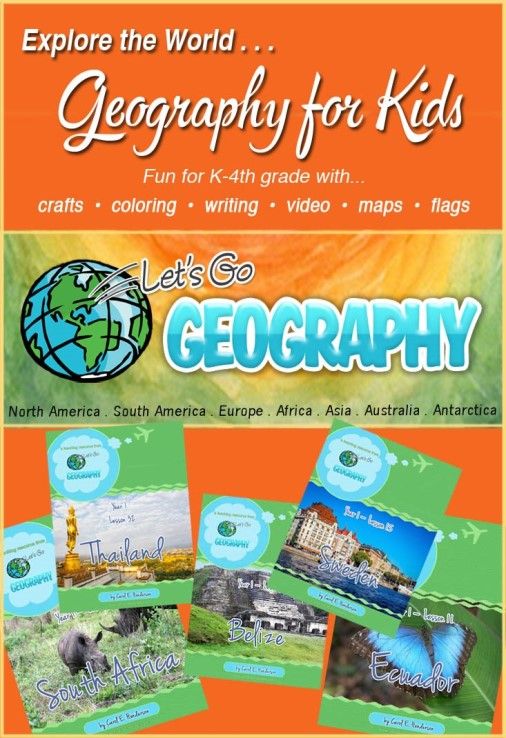
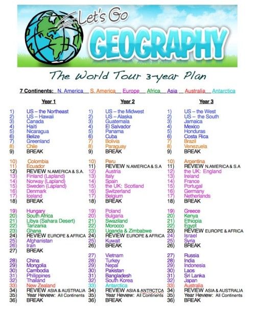
Let’s Go Geography is really a fantastic program that’s listed for grades kindergarten through four but I have learned a bunch from the program myself so I think that it can be used, at least as a supplement, for a lot higher than fourth grade. After you purchase a membership (there are different plans to fit nearly any budget) you will be emailed the link to your first country. You can see the three year plan below. You can also just log into your account and download from there.
Each week is packed with a lot of great information and projects that you can work with at any pace that you want, but since all of the information is divided into five sections then doing a little each day for five days works great. The five chapters cover Mapping the country being studies; the flag of the country; the music of the country; exploring the country; and creating a craft that represents the country. What makes it great is that all printables and links are provided. All you might need are things like colored pencils, glue, etc. (all extra materials that you may need are listed) and, of course, a printer to print off everything.

We love this program! There is so much information but it is covered in such a way that it is very interesting. Let me talk about everything we learned about Canada – week three of the suggested plan. We love Canada and we travel there every year to help out at a camp run by some friends of ours.
The first thing we learned was where Canada was located and a little bit about the country. Younger students are just required to color in the map (sites to printable maps are provided). Older students identify the different provinces and territories as well. All students talk about the countries that border Canada, the rivers, lakes, and the climate.
Next we learn about the countries flag. There are printable flags provided that can be printed off and cut out for multiple students if you have more than one in your family. The student colors in the flag, and either pastes it there “Flags of North America” page or in their passport book that can be purchased separately.
We love the third chapter of each weeks lesson. That chapter is the music from that country. Almost always there is a link to the anthem for that country and most often there is a link to other music from that country. We love the anthem for Canada. Although we are United States citizens through and through, the beautiful national anthem of Canada reminds us of the kids that come to the camp and sing the anthem while raising the flag every morning. We also love hearing music from countries so this section is one of our favorites.
The fourth section is also a favorite of ours. It’s the “Let’s Explore” chapter where there are a ton of links and information to videos and websites that you can use to explore your section. The lesson on Canada has five tremendous links to videos that tell about the people of Canada, the landscape, and popular places to visit. There is also a link to a wonderful site where you can read about all things Canada! I really like that the author of this curriculum also provided the exact area in the library that you would go to find books about Canada. There is also a section with writing suggestions for older students if they want to notebook about the country being studies complete with colored pictures to print and cut out if wanted. Of course, the notebooking page is also provided!
Finally, the fifth chapter gives you craft ideas and coloring pages that can be printed out and created. The craft ideas often feature something that represents a native craft or a craft that uses something that is very distinct to that country. For example, one of the crafts for Canada uses the maple leaf which, of course, is one of the major symbols for Canada. As mentioned before, most of the things needed are provided to print out, and any outside materials are listed at the beginning of each week.
We are absolutely loving Let’s Go Geography! Even Joshua takes a peak at what we are doing and gets interested sometimes. To find out more about this product just click on any one of the highlighted links above. Other members of the Homeschool Review Crew reviewed this company and you can find what they had to say by clicking on the banner below. Happy Homeschooling!


No comments:
Post a Comment